🤖 AI Summary
This work addresses the limitations of existing geospatial user interfaces, which often lack real-time feedback and struggle to support collaborative exploration of migration data by interdisciplinary teams. To overcome these challenges, the authors propose GeoTEAM, a novel geospatial entity interaction system that innovatively integrates active physical knobs with embedded touchscreens, multi-surface displays spanning desktop and wall environments, and real-time visualizations. This design enables users to dynamically manipulate temporal sliders and map layers, facilitating intuitive investigation of net migration patterns and their environmental drivers. Empirical evaluation involving nine interdisciplinary research teams demonstrates that GeoTEAM significantly enhances collaborative efficiency, supports more intuitive sensemaking, and increases users’ confidence in interpreting complex migration datasets.
📝 Abstract
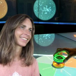
Migration studies is an interdisciplinary field, requiring collaboration between researchers with varying levels of geospatial and quantitative data literacy. Geospatial tangible user interfaces (GTUIs) offer promising opportunities for embodied and collaborative spatial exploration of migration data. Few GTUIs, however, provide real-time visual feedback of data values to help users collaboratively identify trends. To address this gap, we present GeoTEAM, a novel tangible system for real-time, dynamic regional exploration, co-designed with migration and HCI researchers. GeoTEAM features active tangible dials with built-in touchscreens designed to control time and navigate map layers for net migration and various environmental sub-drivers in a multi-surface environment with tabletop and wall displays. We evaluated this system with nine pairs of researchers possessing multi-expertise in geospatial data literacy. Qualitative findings show that our system promotes collaboration, intuitive sense-making, and increased user confidence, enabled by physical interaction and real-time feedback from the active tangibles.